Other Projects
Reach 4B and Eastside Bypass
Reach 4B of the San Joaquin River is a 32.5-mile stretch that begins at the Sand Slough Control Structure and extends to the confluence of the Eastside Bypass and San Joaquin.
Reach 4B has been further divided into two subreaches; Reach 4B1 from the Sand Slough Control Structure to the Mariposa Bypass, and Reach 4B2 from the Mariposa Bypass to the confluence of the Eastside Bypass and the San Joaquin River.
Reach 4B and Eastside Bypass projects consist of incorporating new floodplain and related riparian habitat to ensure conveyance of at least 4,500 cfs through Reach 4B, modifications to ensure fish passage, and modifications in the Eastside and Mariposa bypass channels to support anadromous fish migration. To date, several modifications have taken place in the Eastside Bypass to help achieve these objectives called for in the Settlement.
The Reach O Levee Improvements Project was completed in 2020 and information about that project can be found here. In the future, other work is expected to be conducted at the Eastside Bypass Control Structure to improve fish passage, including construction of a rock ramp which will allow salmon and other native fish passage through the structure.
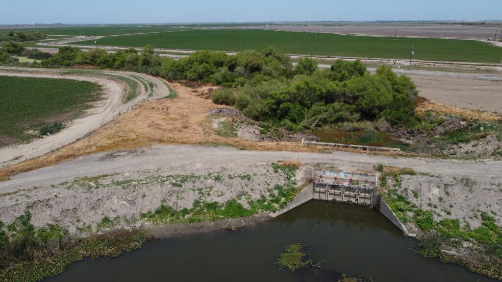
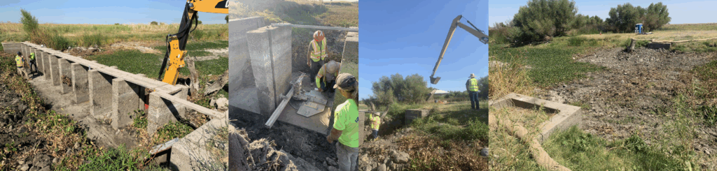
Fish passage improvements have also been made to portions of the Eastside Bypass adjacent to the Merced National Wildlife Refuge. In close coordination with the US Fish & Wildlife Service, which oversees use of the weirs, the two weirs were removed from the bypass channel. The weirs, which were constructed to create seasonal pools for migratory birds on the Refuge, were a partial barrier to adult Chinook salmon and many other native fish. Thus, the Program coordinated with the refuge to provide an alternate water supply to Refuge wetlands.
The first weir heading upstream, the lower weir, was removed in September 2019 as part of the San Joaquin River Restoration Program’s Eastside Bypass Improvements Project.
Below, a time-lapse video shows removal of the lower weir.
The upper weir was removed in the summer of 2021. Together, the removals improve fish passage in the Eastside Bypass. Below are several photos showing the removal.
The Eastside Bypass Improvements Project Initial Study/Final Environmental Assessment consists of the December 2017 Draft IS/EA (Part 1, Part 2, Part 3, Part 4), the Finding of No Significant Impact and Air Quality and Greenhouse Gas Emissions; Biological Resources (Appendices A and B); public comments received (Appendix C); responses to public comments and minor text changes to the EA/IS (Appendix D); Endangered Species Act compliance documentation (Appendix E); and, National Historic Preservation Act Section 106 compliance documentation (Appendix F).
The Draft Technical Summary Report was prepared by the San Joaquin River Restoration Program Team to document technical studies completed as part of the Reach 4B, Eastside Bypass, and Mariposa Bypass Channel and Structural Improvements. Studies in this area started in 2009; this Technical Summary Report documents key technical findings and summarizes the work that led to these findings. The report describes the differences between the routes for high flows through this area and compares these routes. Finally, it identifies potential near-term actions (in addition to the Eastside Bypass Improvements Project) that could provide benefits regardless of the high flow alternative selected. Appendices for this draft technical report include Timing of Flow Analysis (A); Hydraulic and Sediment Studies ( B, Parts 1, 2, 3, 4, 5); Vegetation and Wildlife (C); Soils (D); Wetland Offset (E); Groundwater Analysis (F); Fisheries (G); and, Cultural Resources (H).
Gravel Pit Isolation
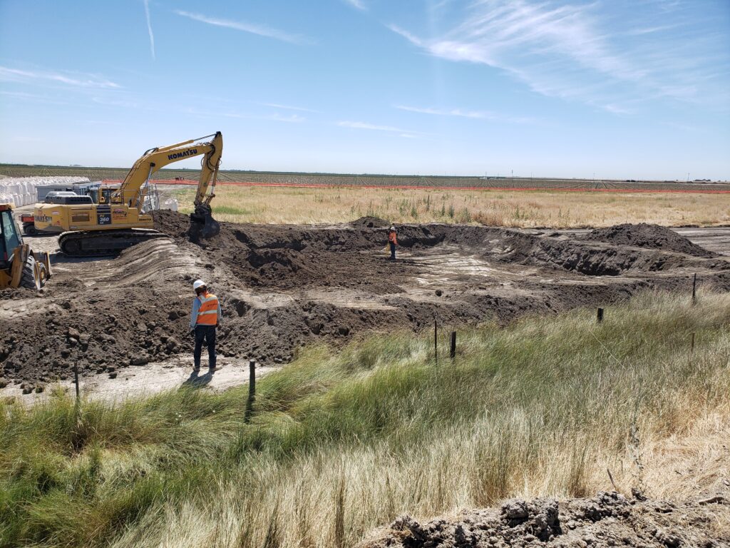
The SJRRP Predation Small Interdisciplinary Group (SIG) developed a draft Pit Prioritization Process document that outlines the general approach to prioritizing gravel pits in Reach 1.
Several studies have collected data and a pit delineation report that inventories pits is in progress. MAP study 2016-8 will continue to synthesize collected data, identify data gaps and initiate a pit prioritization strategy. Future MAP studies will include collection of data gaps and working with the fisheries agencies to refine and finalize the pit prioritization.
As a result, Sycamore Island/Pit 46e was chosen as the first undertaking of its kind for the Program. Environmental review for the project was completed and construction began in 2016. Isolating the ponds helps salmon by keeping them in the river channel and away from predatory fish habitat in the pond. The project repaired a berm breach and isolated a gravel pit pond from the river channel by creating a pervious saddle and gravel road on top of the saddle and berm. In addition to habitat improvements for Chinook salmon and newly created floodplains for fish habitat on both sides of the San Joaquin River, the project increased vehicle access at the Sycamore Island Recreation Area. Construction was completed in 2018.
To learn more about the Sycamore Island/Pit 46e project, read the final summary here.
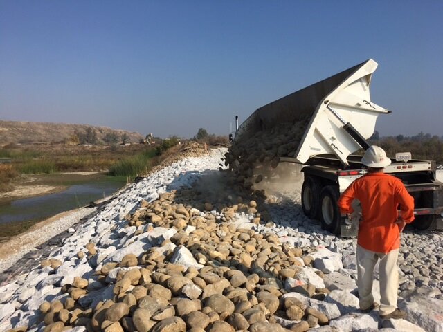
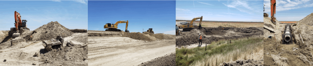
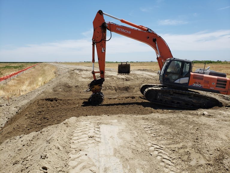
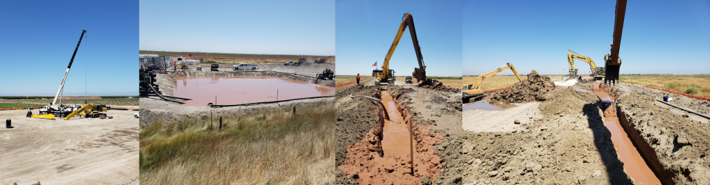
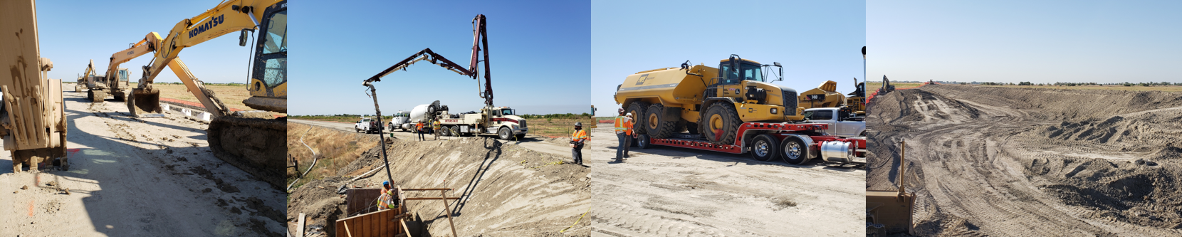
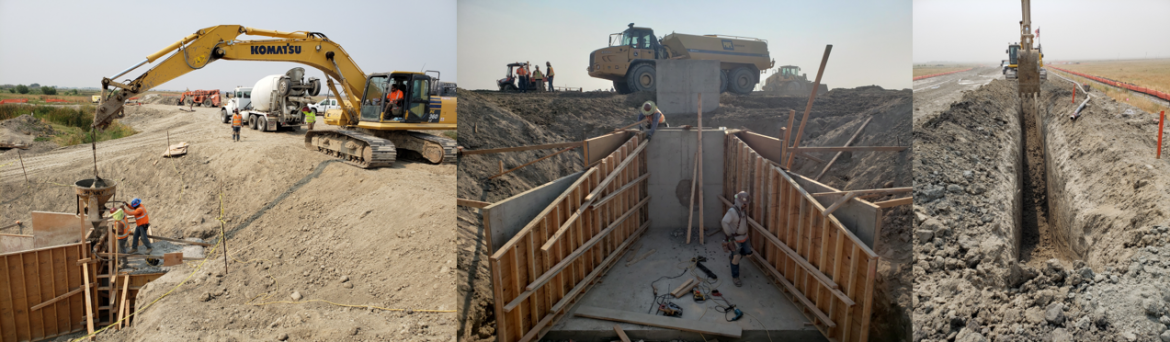
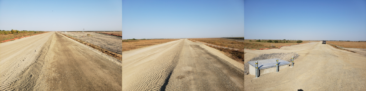
Reach O Levee Improvements
In April 2020, the Department of Water Resources, a partnering agency of the San Joaquin River Restoration Program, began work on approximately two miles of levee along the Eastside Bypass.
The project purpose was to improve levee seepage and stability requirements to allow for higher Restoration Flows. Prior to construction, the levee was constructed of sand or gravelly soils of higher permeability which created seepage conditions during high-water stages and potentially impacted adjacent lands. Once completed in November 2020, the project reduced these impacts after installing cutoff walls to reduce levee seepage and underseepage as well as replacing six aged culverts with concrete reinforced pipe. Below is a chronology of the eight month project.
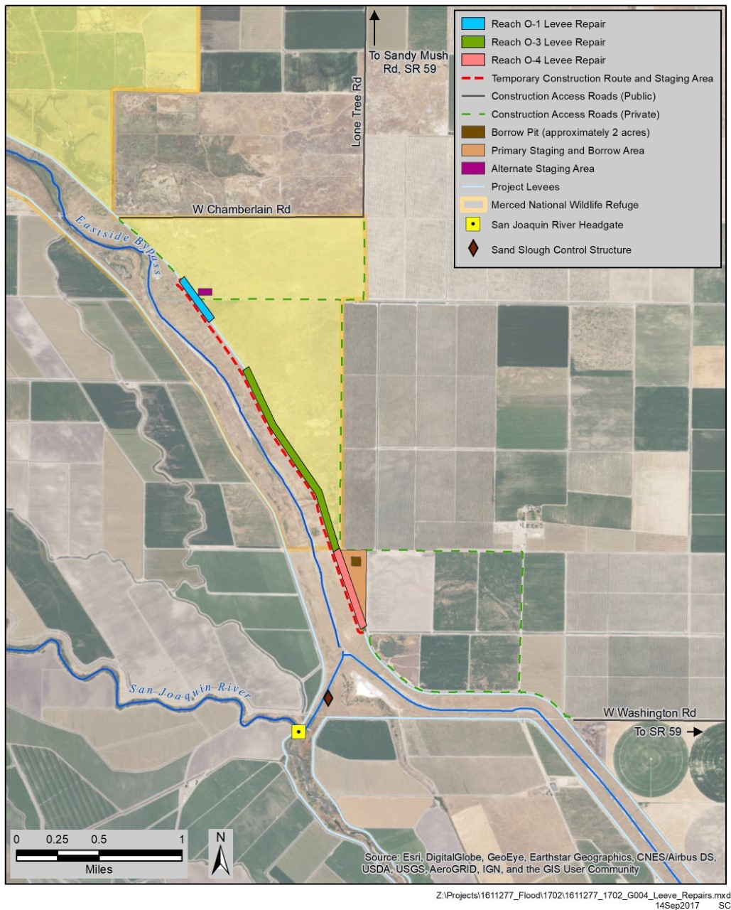
A link to the full project field advisory is here. Below is a map showing the construction area. Map showing proposed Reach O levee work.